Champasak Town and Don Daeng by Bicycle
A slow route through the riverside town, past its old villas and on towards Wat Phou, with Don Daeng waiting across the Mekong.
- From Pakse
- About 1 hour by road
- At its best
- Dry season
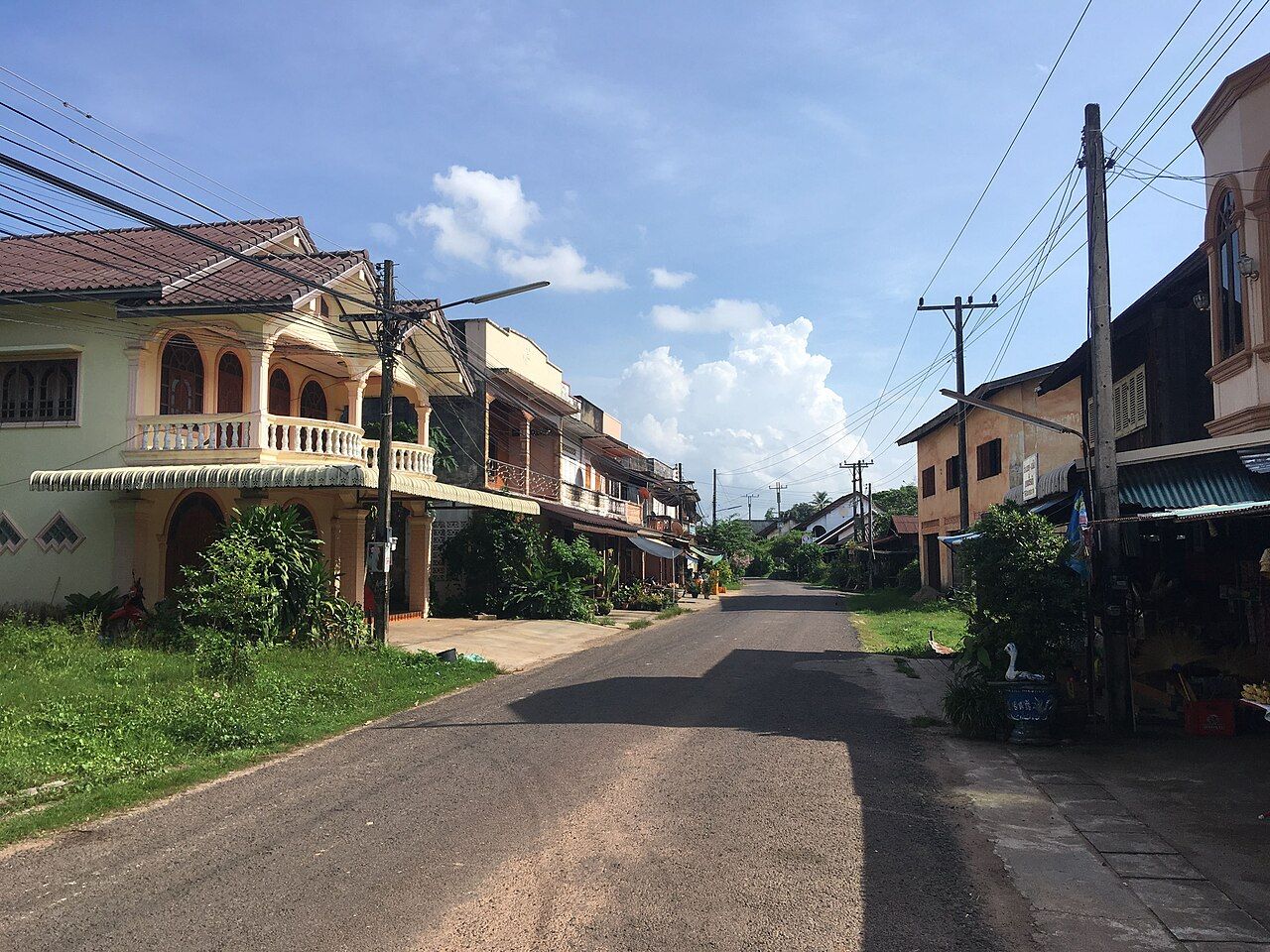
I keep a paper map folded for places that make more sense when nobody hurries through them. Champasak town is one of those places. A single road follows the Mekong, and the island across the water gives the eye somewhere else to go. The bicycle fits the pace round here: no complicated route to explain, just town, river and a road that leads towards Wat Phou.
Start with the shape of the place. Champasak town lies on the west bank of the Mekong, about 35 km south of Pakse. It is spread along one road that follows the river, so the town’s layout is easy to hold in mind. The water stays close to the story, even when the day’s attention shifts from the road to the island opposite. That’s a fine arrangement for a bicycle day. The route is already plain; the hard part is deciding which view deserves another pause.
There’s more behind the sleepy feel than a quiet stretch of river. Champasak was the seat of the Kingdom of Champasak, founded in the early 18th century. The old royal role gives the town a place in the region’s history without changing its modest scale today. The contrast suits the place. The name carries a kingdom, while the town runs along a single road beside the Mekong. It’s a useful bit of context to carry along, not a reason to hurry past what’s here now.
Give the main road a proper look. Several French-era villas stand along it, folded into the long, riverside shape of town. The outing can stay simple, without a grand route or a packed itinerary. The villas are part of the street you’re already moving through; the river is beside it. On a bicycle, that’s enough to make a simple stretch feel like the point of the day. I’m firmly in favour of outings where the road doesn’t demand a big explanation.
Bicycles are a common way to get between Champasak town and Wat Phou. That makes the ride a natural thread through a slow day, rather than a separate expedition that needs dressing up. The town road follows the river, and the route towards the temple gives the bicycle its own purpose. Nobody needs to make a race of it. Around here, a good ride is one where there’s room to notice the place between the starting point and the destination. The map can stay folded for a bit.
The destination has a place in the view and in the day’s plans: the ruined temple up the mountain road. It’s part of the region’s landscape, and bicycles are commonly used to travel between it and town. The connection is pleasingly direct. Town and temple don’t need to be treated as separate worlds; the road links them. The ride also gives Champasak’s single-road layout a practical use, beyond being easy to describe. A paper map is handy for seeing the whole line at once, even if the day is taken in pieces.
Across the water is Don Daeng, a long island in the Mekong facing Champasak town. It has villages and rice fields, with sandy beaches appearing when the river is low. That changing edge is a good reason to leave space in the day for looking rather than ticking off stops. The island is close enough to keep in sight from town, but it has its own shape and settled places. The river keeps the two sides in view, but the day has room for both. That’s my sort of geography.
Small boats carry people and motorbikes between Champasak and Don Daeng. The crossing makes the island part of the town’s everyday landscape, not just a far-off strip on the other bank. A bicycle day can take in both sides without pretending they are the same kind of place. The town has its long road by the river; the island has villages, fields and beaches at low water. I wouldn’t rush through either. The river does the separating, and the small boats do the connecting.
There’s also a car ferry across the Mekong between Ban Muang on the east bank and Ban Phapin near Champasak. It’s another crossing to keep in mind when following the river’s geography. The boats to Don Daeng and the car ferry have different stated jobs, so it’s worth keeping those routes distinct in the mental map. This is a place where the water is not just scenery. It faces the town, divides the banks and carries the crossings that connect them. Even the map seems to slow down here.

The river keeps the two sides in view, but the day has room for both.
By the end of a slow circuit, the road and the water have done enough. Champasak stays along its river line; Don Daeng sits opposite, with its villages and fields beyond the crossing. I fold the paper map and let the two banks remain in view a little longer.